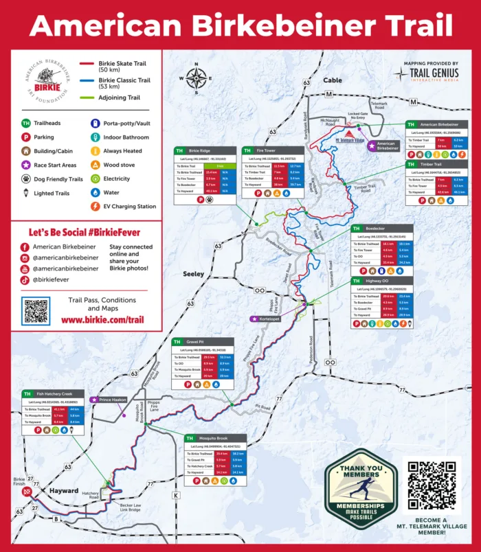
The American Birkebeiner Trail System
4 Seasons, 9 Trailheads, 100+ Kilometers of Endless Outdoor Fun
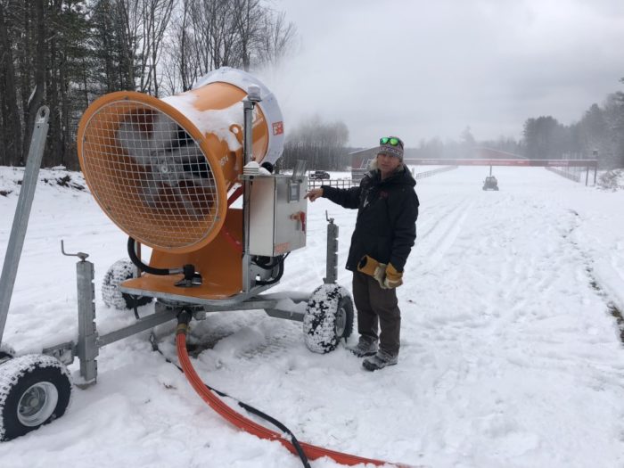
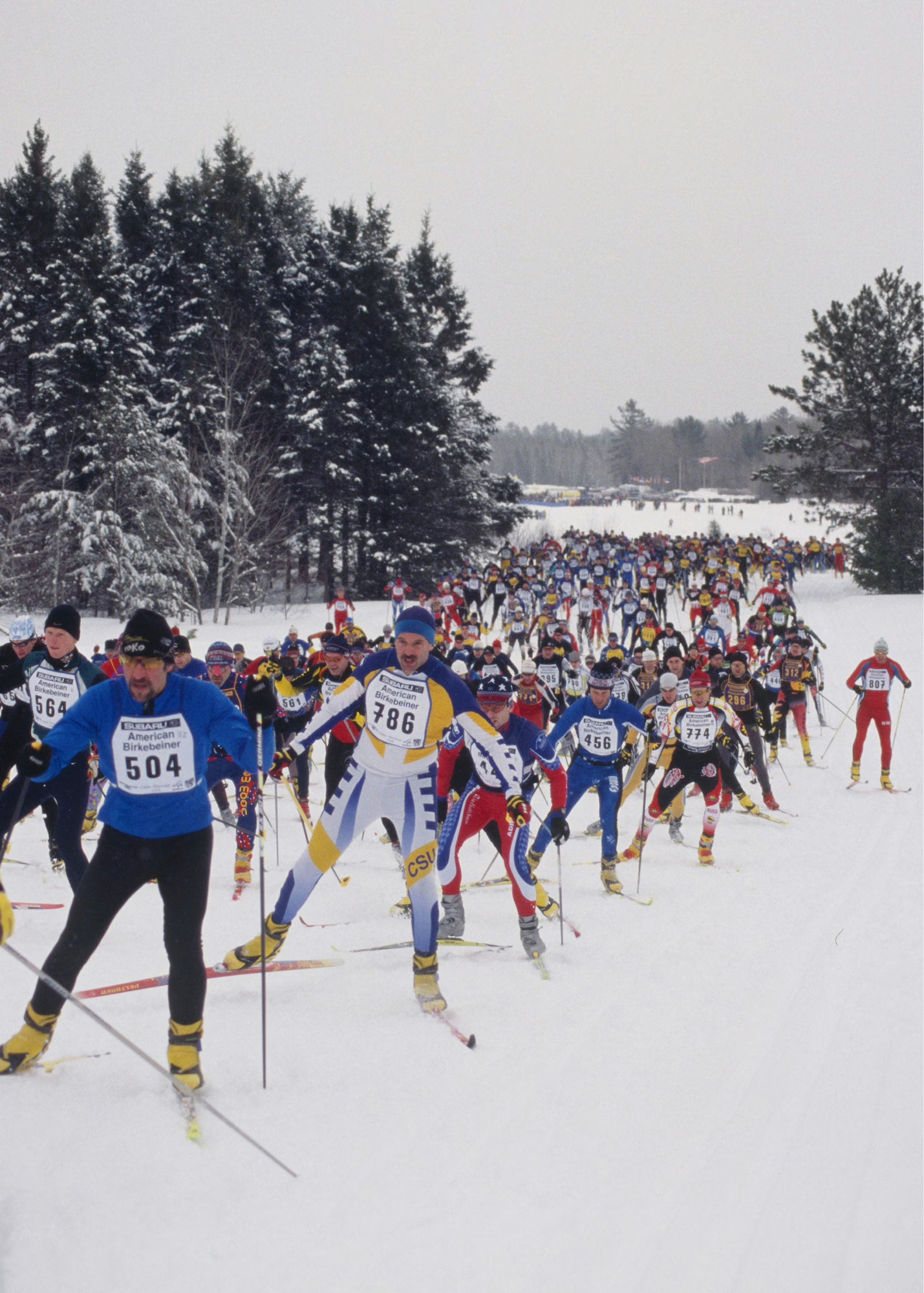
The 100+ kilometer American Birkebeiner Trail system attracts skiers, runners, bikers, trekkers, and hikers seeking fun and adventure in Wisconsin’s Northwoods. Home to events like the Slumberland American Birkebeiner, the Fat Bike Birkie, and the Birkie Trail Run, the trails are maintained by our world-class Birkie Trail Staff and are open to the public year-round.
The newest addition to the American Birkebeiner Trail System, Mt. Telemark Village, is home to the Tormondsen Family Snowmaking Loops, Trek Mountain Biking Trails Powered by OTM, and kilometers of year-round trail systems!
The non-profit 501(c)(3) American Birkebeiner Ski Foundation maintains 100% of the trail system. Learn about donating to support the trails here.
Birkie Trail ski passes are required December – March to ski on any part of the 100+ kilometer American Birkebeiner Trail System. All Access ski trail passes are required anytime skiable snow is present on the Mt. Telemark Village trails and Tormondsen Family Snowmaking Loops. Passes are available in a season or day pass. Day passes are valid for any section of trail during the winter season for one calendar day. 100% of funds collected go toward our growing costs to maintain the trail.
Winter trail use passes comes in two options: All Access or Birkie Trail Only. All Access includes Mt. Telemark Village Trails including the Tormondsen Family Snowmaking trail at all times of the winter season, and the Birkie Trail. Birkie Trail Only passes includes only naturally groomed snow on the greater Birkie Trail. Any ski trail access from Mt. Telemark Village requires an All Access Trail Pass.
There are no longer physical trail pass cards. Please follow the link in your confirmation email or in your account to download your digital trail pass. You can save this in your Apple Wallet, as an image, or print it out. Trail passes are not required for summer use but if you would like to support our trail maintenance efforts please visit our Give page.
| PASS TYPE | Regular Season Birkie Trail Pass (Groomed, natural snow. Valid once the greater Birkie Trail officially opens) | All Access Season Trail Pass (Snowmaking, MTV, and greater Birkie Trail system) | Daily Pass Pricing for ANY one Day (Birkie Trail or Snowmaking Trail): | 3 Day Daily Pass Pricing for 3 Consecutive Days (Birkie Trail or Snowmaking Trail): |
|---|---|---|---|---|
| Adult (ages 19+) | $50 | $120 | $10 | $27 |
| Family (2 adults and children ages 13-18 with same address) | $125 | $280 | $25 | $70 |
| Youth (Ages 13 - 18) | $25 | $50 | $5 | $12 |
| Kids (12 and under) | Free | Free | Free | Free |
| Team Pass for Middle/High School/College Team or Club* | NA | $500 | $95 | NA |
By order of the Sawyer County Board of Directors, no person may use that portion of the American Birkebeiner Trail System in Sawyer County between December 1st and March 31st unless they have purchased a Trail Pass. Sawyer County grants to the named holder of a Trail Pass a revocable temporary license to access the Trail System.
*Adult clubs, or large groups, please email erin.blow@birkie.com for rates.
**Team, club, or large group looking to reserve a space to stash your gear and hang out? Reserve a space in the Derksen Great Hall. Email erin.blow@birkie.com

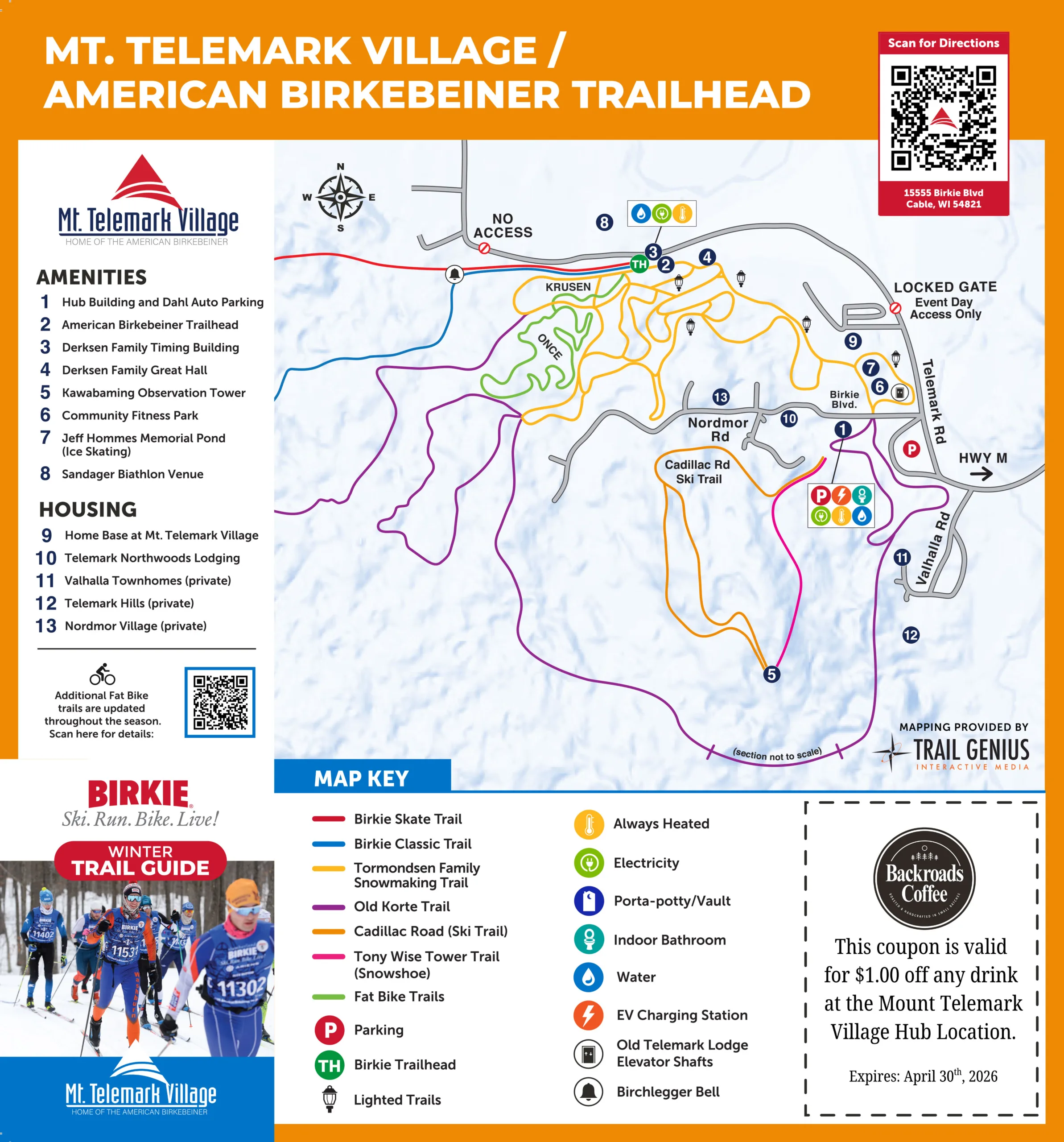
 Roller Ski Loop Trail Map at Mt. Telemark Village and the American Birkebeiner Trailhead
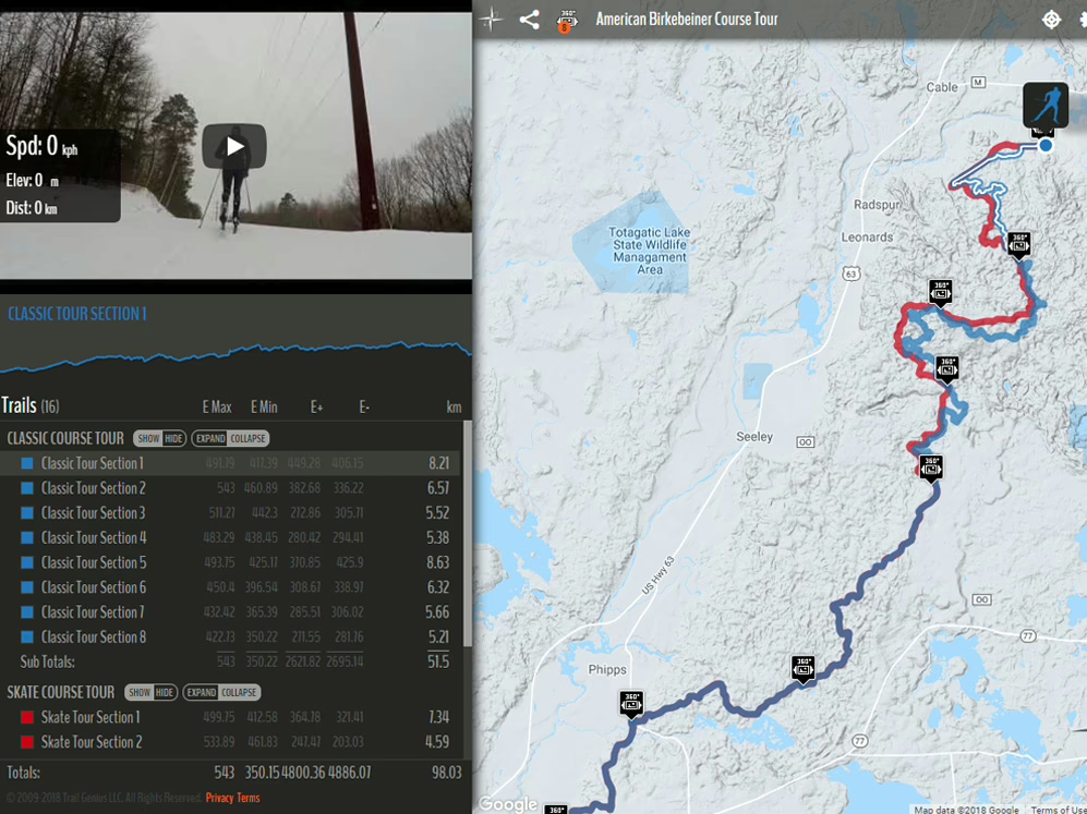
Virtual Birkie Trail Tour
Experience the amazing Birkie trail, named the No.1 cross-country ski destination in the U.S. Explore every section of the trail, including trailside cabins, as you virtually ski from near Cable, WI, to near Hayward, WI. Immerse yourself in the great north woods whenever or wherever you are!
Tour the Interactive Birkie Trail Map »
Or, Tour the Race Course on Race Day »
Trail Maintenance FAQs
Learn more about American Birkebeiner Trail System Maintenance at Birkie Trail Grooming Procedures and FAQs.
Choose Your Trailhead
The American Birkebeiner Trail System boasts 9 trailheads between Hayward and Cable, WI – that’s 9 places to park for your ski, run, bike, hike or run! Trails are open year-round and are available for public use. No motorized vehicles.
- Mt. Telemark Village Hub
- American Birkebeiner Trailhead
- Derksen Family Great Hall
- Derksen Family Timing Building
- American Birkebeiner Trailhead
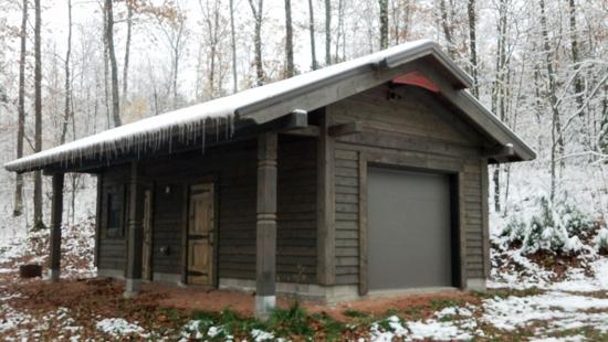
- Timber Trail Cabin at Birkie Trail 43K
- Franzen Fire Tower Trail Cabin at Birkie Trail 38K
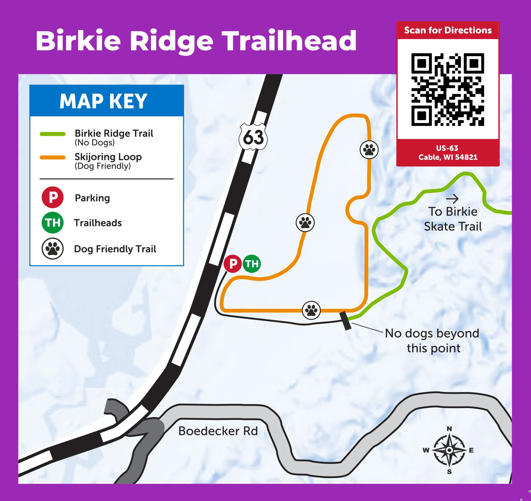
- Birkie Ridge
- Mandli Boedecker Trail Cabin at Birkie Trail 33.5K
- Samuel C. Johnson Family Outdoor Center (OO) at the Kortelopet Trailhead
- Birkie Trail 29K Trailmarker
- Strand-Johnson Gravel Pit Trail Cabin at Birkie Trail 20K
- Birchleggings Club Mosquito Brook Trail Cabin at Birkie Trail 14K
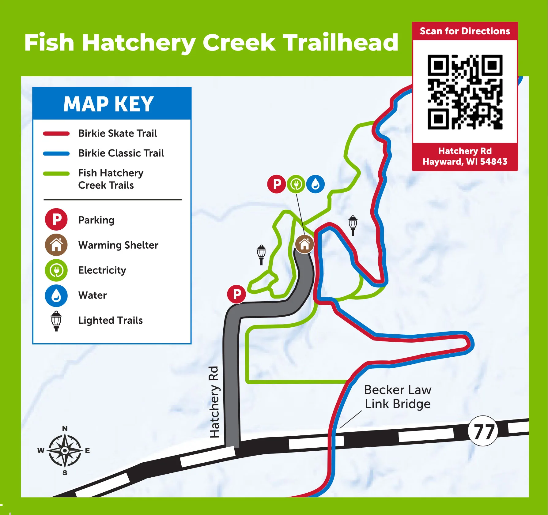
- Hatchery Creek County Park at Birkie Trail 8K
How to Get to the American Birkebeiner Trailhead
The American Birkebeiner Trailhead is accessed directly for events, please follow event directions for access. For daily use go to the Mt. Telemark Village Hub and access the trails from that trailhead. You will be able to travel through the American Birkebeiner Trailhead on all trails by starting at the Hub.
From Hayward, take Highway 63 North to Cable, turn right/East on County Highway M to Telemark Road. Follow Telemark Road until it dead ends at the Derkson Family Great Hall/Birkie Trailhead. Some maps may show access from McNaught Road, but access is now only available from Telemark Road.

Stay and Play Year-Round at Mt. Telemark Village
Mt. Telemark Village in Cable, WI, is the American Birkebeiner Trail System headquarters, boasting 30+ miles of state-of-the-art mountain biking, paved recreational loops, winter snowmaking trails, and access to the Birkie Trail, home of the American Birkebeiner ski race.
Trek Trails Powered by OTM
Enjoy 16 miles of state-of-the-art mountain biking trails at beautiful Mt. Telemark Village, built and maintained by the ABSF, Trek, and OTM. There are trails for every ability and skill level, all free and open to the public! Check out trail maps and conditions here.
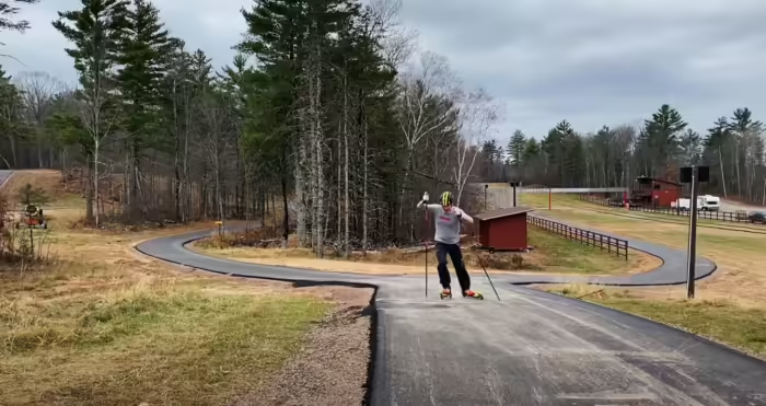
George Hovland Paved Recreational Loop
Rollerski, walk, bike, or run on the George Hovland Paved Recreational Loop. 5K of immaculately paved trail allows everyone from professional athletes to casual recreationists to get outdoors. View trail maps here.
Tormondsen Family Snowmaking Loops
You can always count on beautifully grooming snow with the Tormondsen Family Snowmaking Loops. Located at the American Birkebeiner start line, enjoy consistent and challenging terrain. Trail passes are required in the winter. Learn more here.